


 HOME
HOME Subway
 Bus
Bus See Osaka
 Imazato Liner (BRT)
Station map
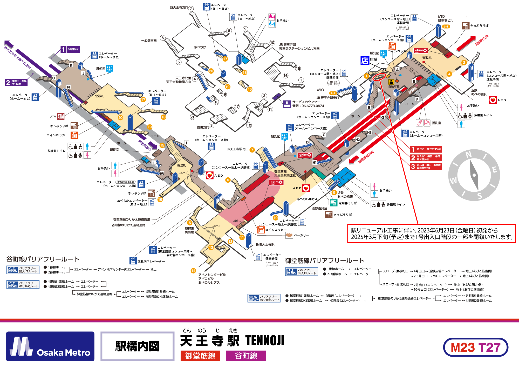
Station facilities and facilities
-

Elevator
-

Escalator
-

Stairway
-

Toilet
-

Wheelchair-accessible Toilet
-

Multi-function Toilet
-

Tickets
-

Commuter Pass Seles Counter
-

Coin Lockers
-

Tactile Map
-

AED
-

Exit No.
-

Service Counter
-

ATM
-

First Aid Room / Nursing Room
-

ID Photo Machine
Barrier-free entrance/exit route
- Elevator

- Slope & Higashi Gate
- Exit 4
- Kintetsu Hiroba Elevator
- Ground level (Abikosuji south side)
- Elevator
- Slope & Higashi Gate
- Exit 2-B
- MiO Elevator
- Ground level (Abikosuji north side)
- Elevator
- Slope & Nishi Gate
- Exit 7 (Elevator)
- Ground level (Abikosuji north side)
- Elevator
- Slope & Nishi Gate
- Exit 10 (Elevator)
- Ground level (Abikosuji south side)
- Elevator
- Slope & Higashi Gate
- Exit 4
- Kintetsu Hiroba Elevator
- Ground level (Abikosuji south side)
- Elevator
- Slope & Higashi Gate
- Exit 2-B
- MiO Elevator
- Ground level (Abikosuji north side)
- Elevator
- Slope & Nishi Gate
- Exit 7 (Elevator)
- Ground level (Abikosuji north side)
- Elevator
- Slope & Nishi Gate
- Exit 10 (Elevator)
- Ground level (Abikosuji south side)
- Stairway D (Elevator)
- Connecting elevator to Midosuji Line
- Elevator to Tanimachi Line Platform 1
- Stairway D (Elevator)
- Connecting elevator to Midosuji Line
- Elevator to Tanimachi Line Platform 2
- Stairway H2 (Elevator)
- Connecting elevator to Midosuji Line
- Elevator to Tanimachi Line Platform 1
- Stairway H2 (Elevator)
- Connecting elevator to Midosuji Line
- Elevator to Tanimachi Line Platform 2